A case for Zambian clay huts
Cloud school
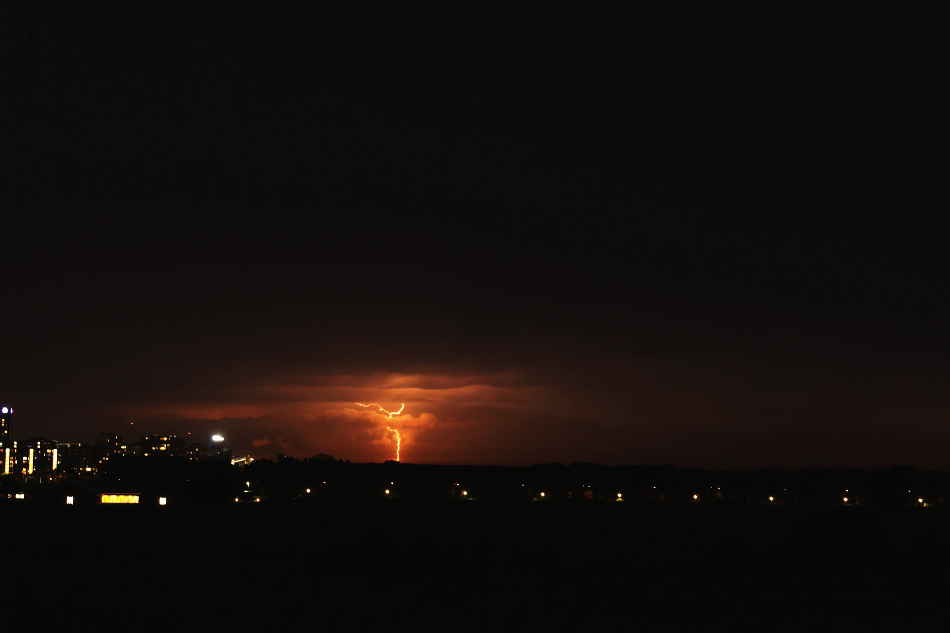
While Denmark doesn’t strike many as a place with severe weather events, the nation often ends up getting caught in between a dramatic battle between hot and cold.
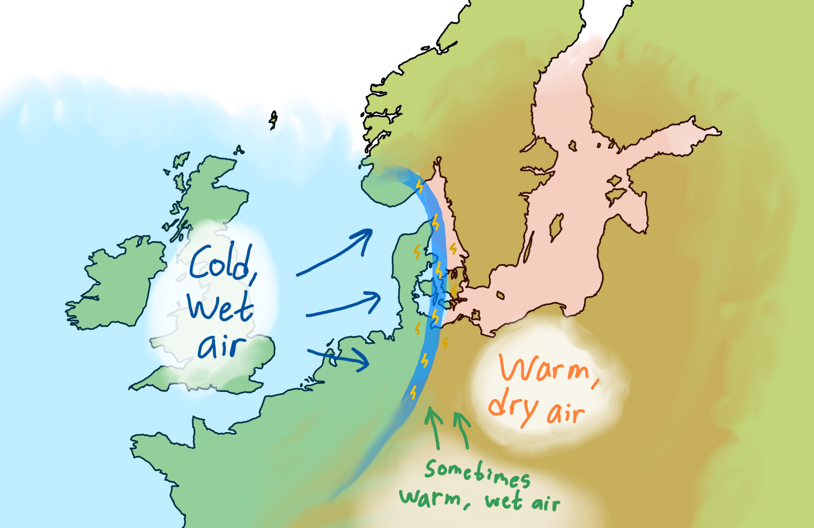
As the summer peaks from June to August, regional volumes of warm air flow from Central and Eastern Europe, sometimes fuelled by moisture from the Mediterranean. This warm air collides with cooler and wetter air originating from the west (think the North Atlantic) which then triggers long-lasting systems of thunderstorms that can travel for hundreds of kilometres over a day or more.
In the image at the top, a lightning bolt is seen striking from such a large system approaching from Germany. Below is an idealised schematic of the described process.

Thomas Heising here!
I’m originally from Denmark, but now living in Cork, Ireland and working with visual science communication. You may have found this post because you were curious about this page or wanted to know more about the topic at hand – in any case: welcome.
There are more writings, visuals and videos around here about geology, the weather, our planet, Ireland, Denmark and other things that interest me.