Amphibian oasis
Irish nature
One summer day, the 2nd of July 2011 specifically, after visiting a friend in the provincial city of Roskilde, I embarked on the train journey home to Copenhagen – blissfully unaware of the drama ahead.
The same afternoon, a thunderstorm cloud developed over southern Sweden tracking west towards Copenhagen. No one had foreseen the growth it would undergo as it travelled over the strait of water Øresund separating Sweden and Denmark. Over a short amount of time, the thundercloud literally exploded, likely drawing in moist air from Øresund. And what goes up has to come down.
As I neared central Copenhagen, the clouds were dropping monumental amounts of water and hail on the city. It was what we in Danish call “et skybrud” – a cloudburst. Luckily for the sake of documentation, I had my video camcorder with me.
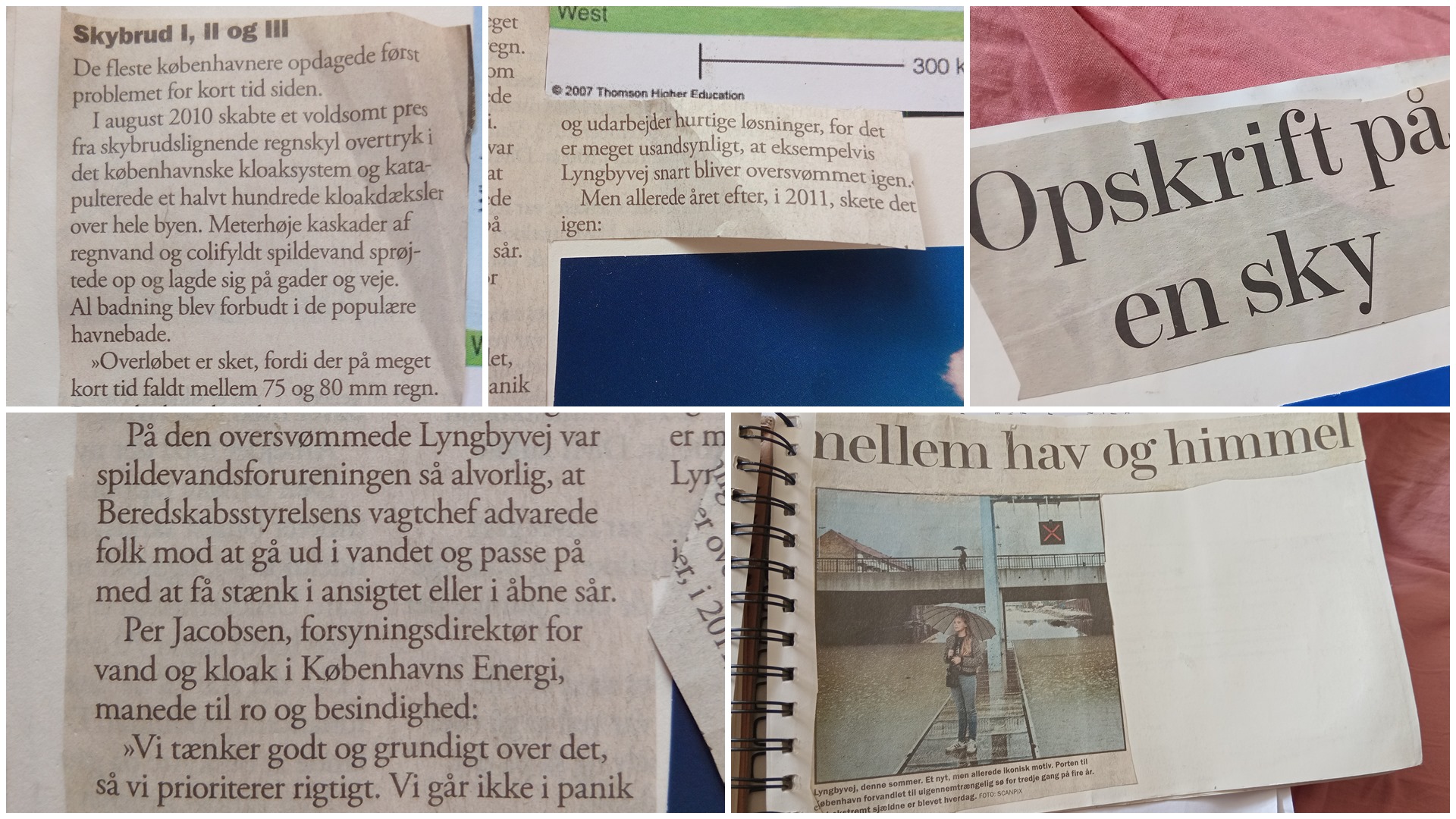
135 mm of rain was recorded at the Botanical Gardens in the city centre and streets became flooded in minutes as seen in the footage above.
Cumulonimbus clouds like the one that dropped millions of tonnes of water on Copenhagen in 2011 are hard to predict. Their likelihood of happening can be predicted on a particular day, but the exact hour, position and intensity are difficult properties to pin down.
The year prior to in August 2010, another cloudburst had been responsible for 80 mm rain and caused flooding across the city. But that paled in comparison to the disastrous outcomes of the thunderstorm of July 2011.
If you need to be prepared, reading the clouds and checking live data yourself is always the best way to go.
Also:
I really, really hate that I have to state this, but there’s so much Generative AI-slop out there (yes, even content that pretends to be scientific). Know that I do not use AI for any of my writings, visuals nor thoughts. It’s all written and visualised by a human, meaning me, unless stated otherwise. Therefore, you can always reach out to me if there’s anything factually or grammatically incorrect.
Now, thank you for your interest in this page – I hope you enjoy it!
References:
https://www.dmi.dk/nyheder/2012/2-juli-et-aar-siden-det-koebenhavnske-skybrud
https://www.dmi.dk/nyheder/2011/forventet-skybrud-men-uventet-styrke/