Lovecraftian horrors of Cork
Irish nature
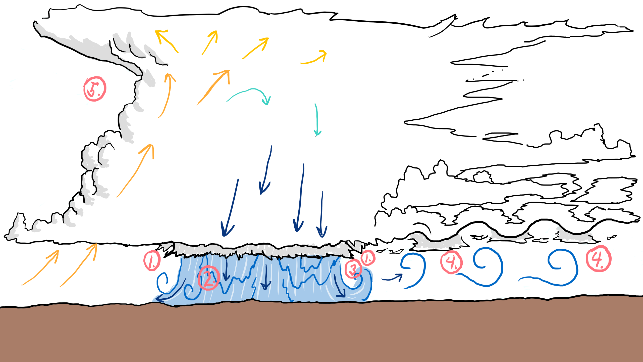
Numbers below correspond to the timecodes for the video at the top:
Clouds can weigh millions of tons with most of this being water suspended in the atmosphere.
The question is how does millions of tons of water stay floating kilometres above our heads? Well… they can’t really on the long run, hence it all comes crashing down as rain, hail, sleet or snow.
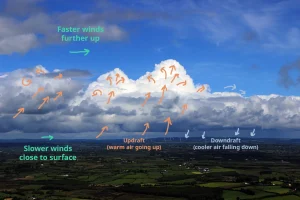
But thunderstorms are impressive as they seem to defy gravity while they’re building. In fact, the reason why all that water ends high up in the sky is a matter of density.
Warm air has a lower density than cold air and thus a bubble of warm air rises relative to surrounding cooler air. Due to some interesting thermodynamic processes, if there’s a lot of moisture in the air, it will even travel faster upwards while forming dense cloud formations called cumulonimbus clouds. This can literally lift unbelievable masses of air and water twenty kilometres up into the atmosphere before it all falls down on us.
As it falls, it can form beautiful turbulence and wavy cloud structures such as these asperitas underneath the thunderstorm. These can be seen in the video at 0:16.
Music licensed from soundstripe.com
References:
https://learningweather.psu.edu/node/87