Decapitated thunderstorms
Cloud school
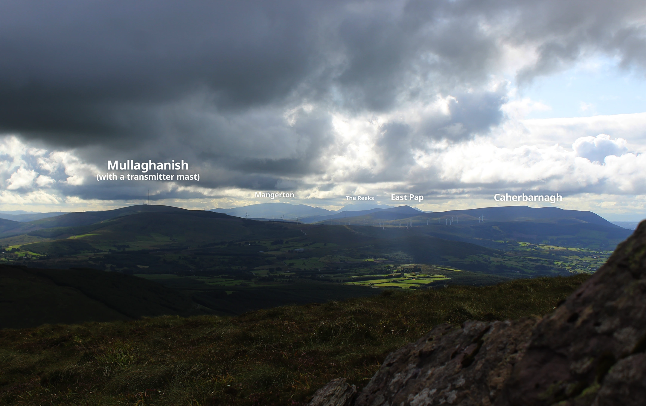
Musheramore is one of those hillwalks where you’re constantly granted an expansive vista as you plough upwards. Depending on there not being low-lying clouds of course.
But even then on a cloudy day, it’s possible to see far enough as in the image above. The tallest mountains in Ireland (The Reeks) can be spotted west behind Mullaghanish and Mangerton.
The hike up Musheramore is steep enough and can be slippery. But it’s difficult getting lost traversing up as the path goes in one direction all along. While the top is flat and expansive, spatial awareness can be secured using the cairn and triangulation station, and by following the fence up there.
Enjoy!
References:
1. https://en-ie.topographic-map.com/
Thomas Heising here!
I’m originally from Denmark, but now living in Cork, Ireland and working with visual science communication. You may have found this post because you were curious about this page or wanted to know more about the topic at hand – in any case: welcome.
There are more writings, visuals and videos around here about geology, the weather, our planet, Ireland, Denmark and other things that interest me.